Zero downtime in remote areas
Deep valleys, dense forests, and remote infrastructure corridors do not have to stall the project timeline.
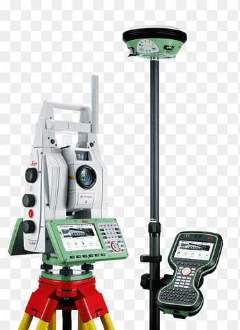

We deliver complete DGPS survey services in extreme, remote zones with zero network signals or GPRS connectivity.
Where traditional GPS workflows depend on network communication, our offline differential baseline processing and advanced satellite-receiver setups keep projects moving with centimeter-level coordinate accuracy across India.
By capturing precise raw terrain in disconnected environments, we provide the georeferenced groundwork that powers the rest of your digital construction workflow.
Offline processing for remote infrastructure corridors, forests, valleys, and other signal-challenged terrain.
We bridge raw terrain and fully operational designs by feeding high-precision field data directly into digital modeling and engineering pipelines.
Deep valleys, dense forests, and remote infrastructure corridors do not have to stall the project timeline.
Ultra-precise field dimensions give structural and MEP design teams a reliable starting point.
Surveying, BIM coordination, MEP execution, and final digital handover follow one connected workflow.
BIM Level of Development (LOD) is a framework that defines the reliability and detail of information in BIM models at each project stage, ensuring clarity and precision for all stakeholders.
Building Information Modeling (BIM) has completely changed the construction industry by letting us create detailed digital representations of building projects. At ASquare Technologies, the BIM Level of Development (LOD) is central to how we work. This powerful framework helps us define the reliability and detail of information in our BIM models at every stage of a project. From initial concepts to detailed fabrication and final as-built documentation, our use of LOD provides a clear, structured pathway for project progression. It ensures all stakeholders have precise expectations about the model's accuracy and usability, fostering improved collaboration, reducing ambiguities, and enhancing overall project efficiency and quality throughout the entire lifecycle of a building.
Basic graphical representations using symbols or generic elements for early project visualization.
Generic systems with approximate size, shape, location, and orientation.
Accurate geometry suitable for coordination and detailed design.
Detailed fabrication, assembly, and installation information.
Field-verified models representing final constructed conditions.
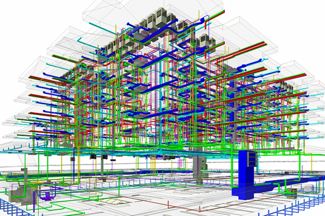
3D modeling revolutionizes Mechanical, Electrical, and Plumbing (MEP) systems by creating realistic virtual representations of building infrastructure. It improves project outcomes, streamlines workflows, and enhances coordination throughout the construction lifecycle.
In modern construction, Mechanical, Electrical, and Plumbing (MEP) systems are essential to any building. At ASquare Technologies, Digital Construction for MEP revolutionizes how we design, coordinate, and install these complex systems. By harnessing advanced 3D modeling and digital tools, we create highly accurate virtual representations of all MEP infrastructure. This approach allows us to achieve early clash detection, precise material take-offs, and optimized installation sequences, drastically minimizing errors and rework on-site. The result is a more efficient, cost-effective, and sustainable construction process that delivers superior building performance and a streamlined project lifecycle for our clients.
Off-site fabrication with higher quality control and faster installs.
Accurate drawings generated directly from 3D models.
Precise material take-offs reduce waste and cost.
Optimized designs for long-term operational performance.
Drone flight planning and real-time 2D/3D mapping.
Advanced GIS analysis and 3D visualization.
Open-source GIS for spatial data editing and mapping.
Photogrammetry software for generating 3D spatial data.
Industry-standard drone photogrammetry platform.

Delivering transformative, cost-effective surveying and geospatial solutions to support development, compliance, and innovation.
0866 3102004
+91 7981437982
+91 80084 30439
Flat No:203, 2nd Floor, Arien Apartments,Panjagutta Officers Colony, Hyderabad – 500082
D.No 54-16-8/2 Plot No: 84, Road No. 5, Beside Vinayak Theatre Lane, Venkateswara Nagar, Vijayawada - 520008
info@nscllp.in